The problem
A Community Wildfire Protection Plan has to say where the fuels are relative to the homes, parcel by parcel, and it has to hold up in a council meeting. The city needed canopy structure across the whole town.
What we flew
- Drone LiDAR across the city in 2024, about 4,300 acres at 250 feet above ground in two and a half weeks
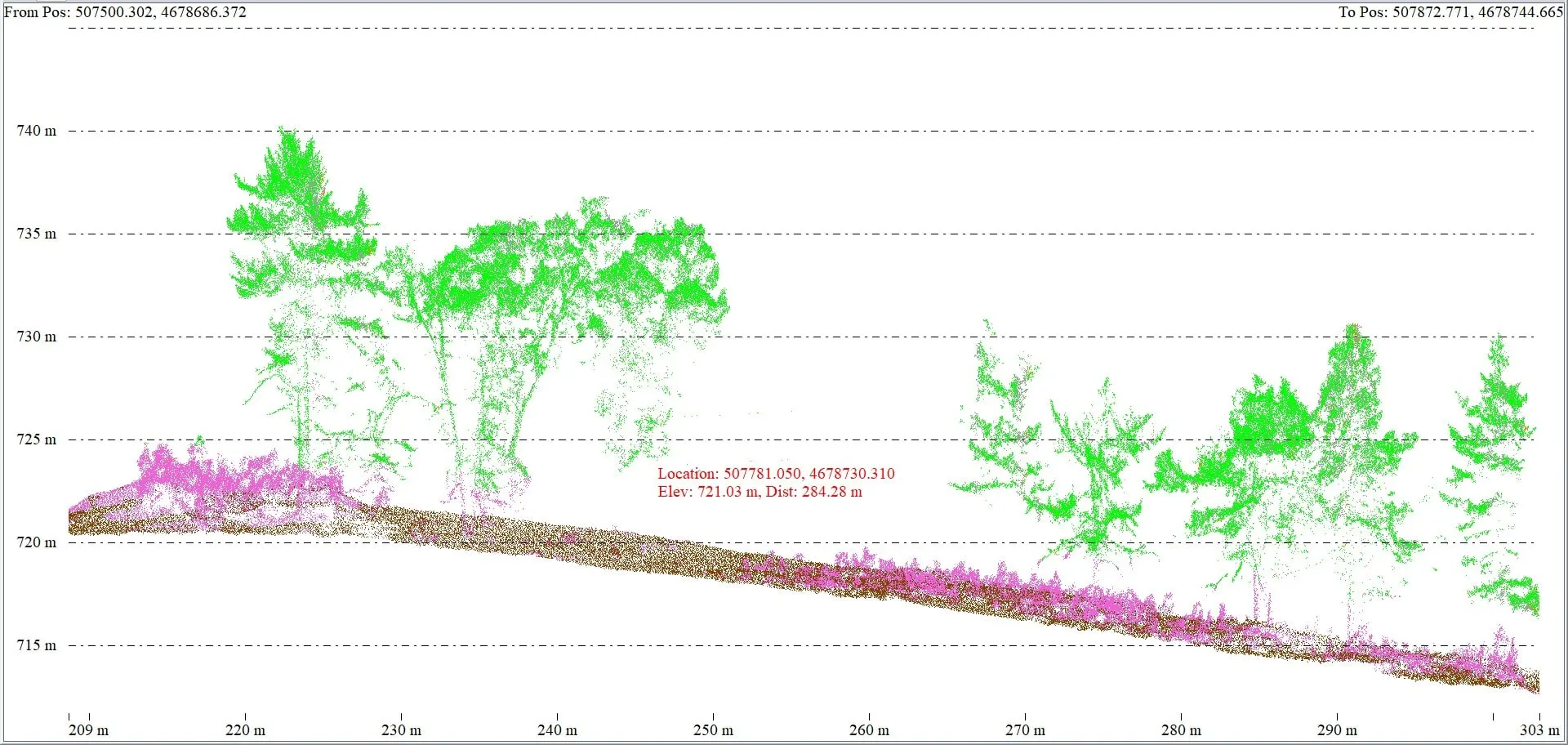
- Processed to a classified point cloud, bare earth, surface, and canopy height
What we delivered
- Bare earth elevation model, surface model, and canopy height model
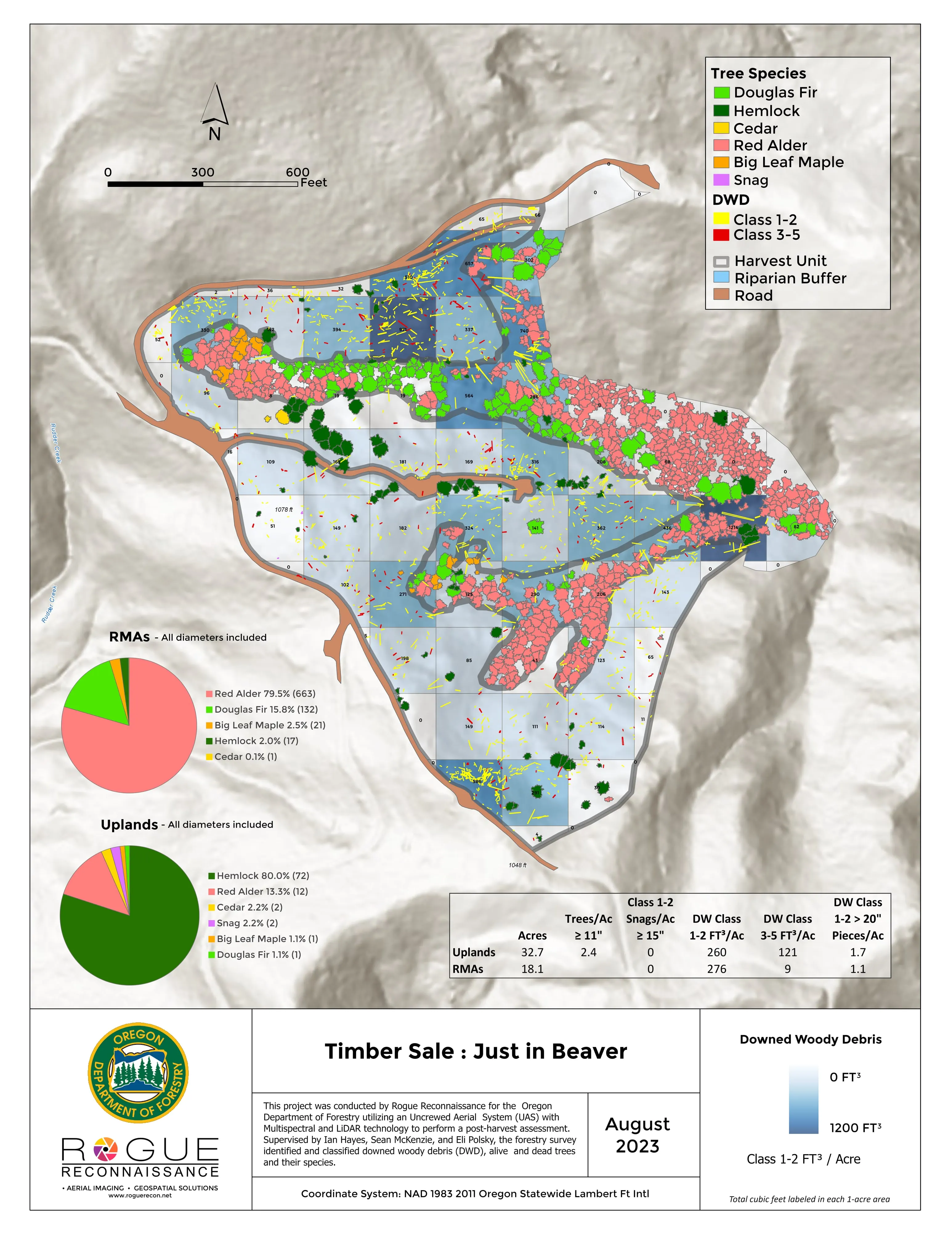
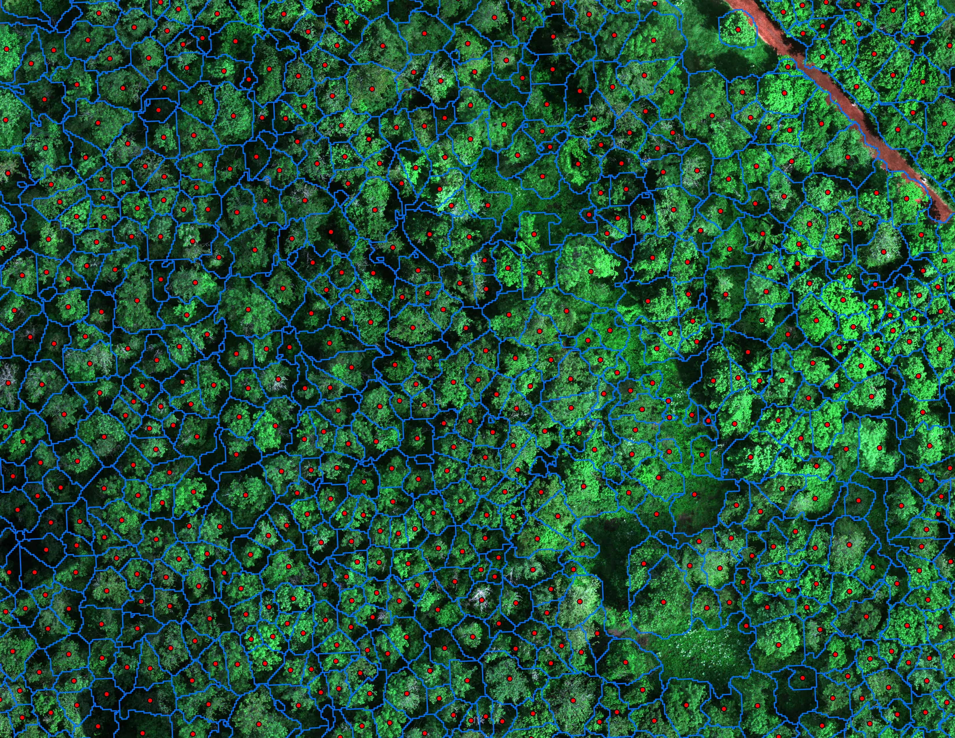
- Individual tree canopy polygons
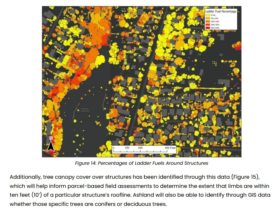
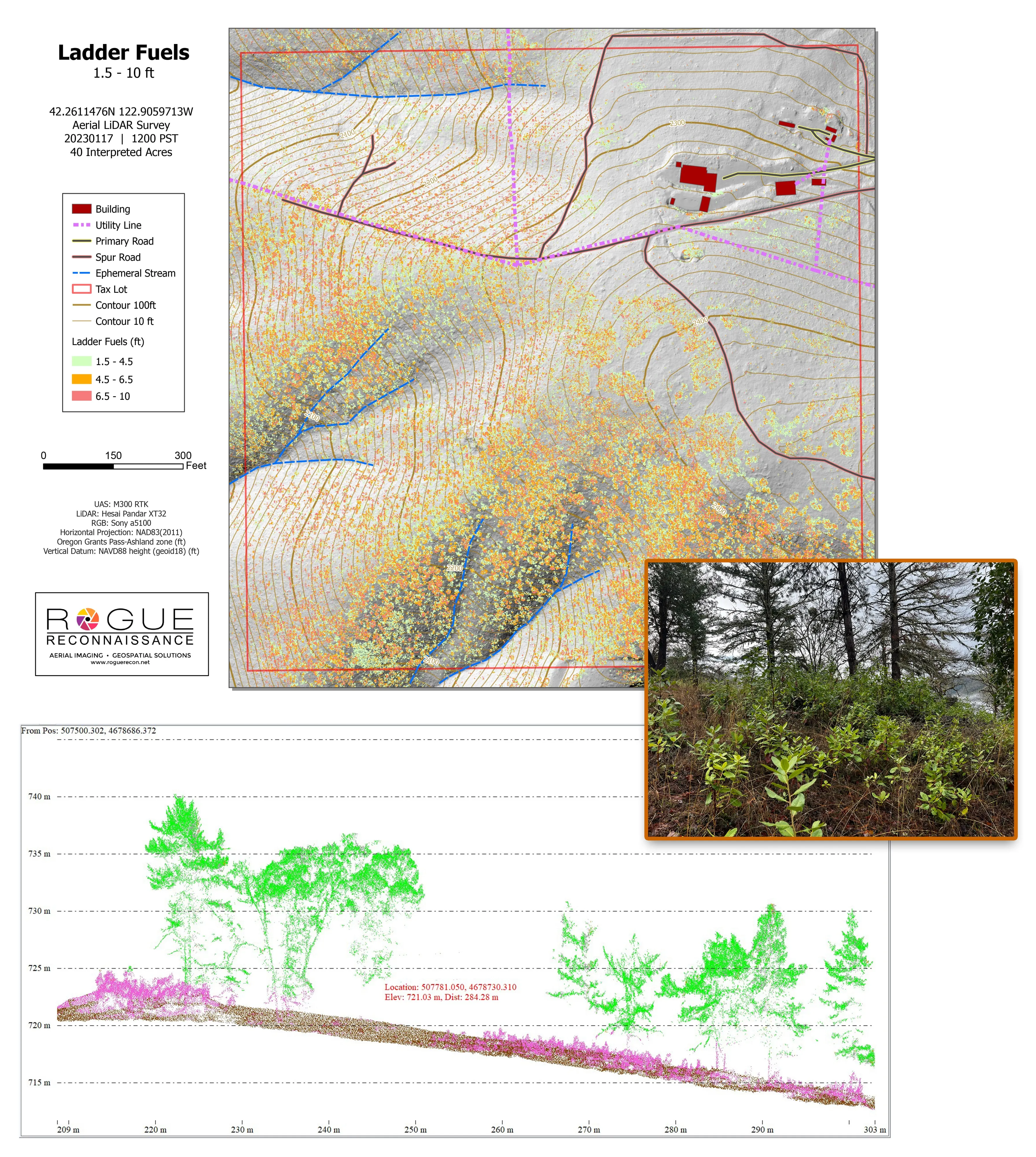
- Ladder fuel identification from the vertical structure of the point cloud
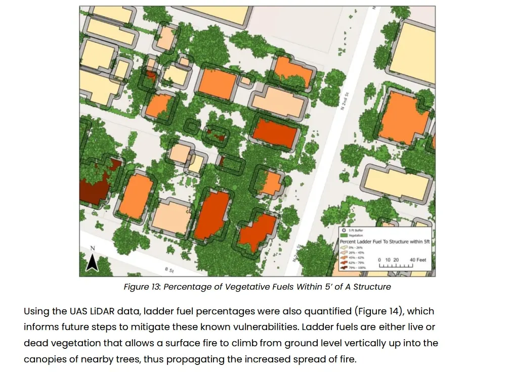
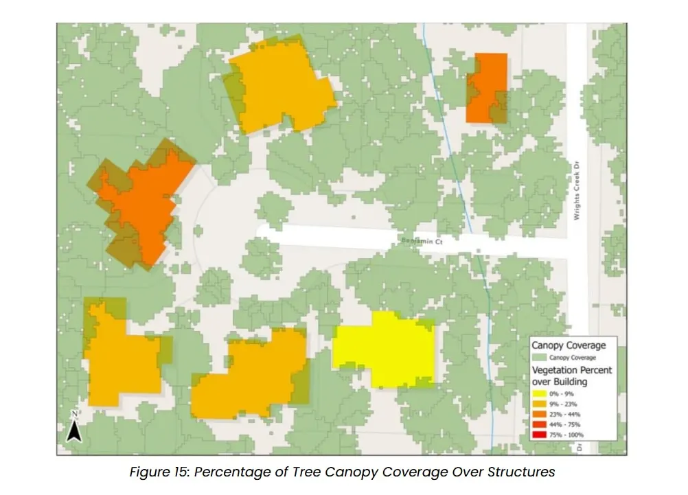
- Vegetation buffer analysis around structures: ladder fuel percentages around each structure, vegetative fuels within five feet of a structure, and canopy cover over rooftops
- Delivered into the city's GIS in direct support of city staff
A canopy height model is a fuels map if you build it for fuels. Ground, low, medium, and high vegetation come out of the same classified point cloud, and that separation is what makes a ladder fuel call possible.
The plan is public, and the figures in it came off this data.