

California
Drone LiDAR and fire mapping across Northern California.
River corridors, mine sites, timber, and fire. We have flown Siskiyou, Shasta, and Mendocino counties, and the same aircraft and sensors go anywhere in the state.
What we fly in California
The river, the ridge, the mine site, and the fire
Medford sits an hour from the state line. A California job gets the same flight and the same products as the Oregon work on this site: drone LiDAR for the ground and the trees, multispectral for what is alive and what is not, thermal for water and for fire, and a current orthomosaic to draw on. Products come back in California State Plane or UTM, NAVD88, in the formats the agency, the forester, or the engineer already uses.
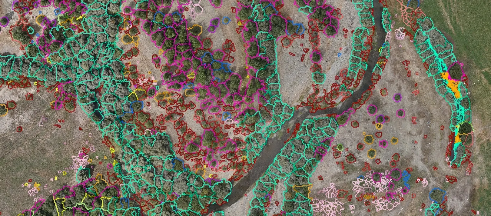
- Riparian species mapping and thermal cold water mapping for restoration partners and fisheries groups
- Drone LiDAR under the canopy for habitat, mine site, and watershed work on federal, state, and tribal land
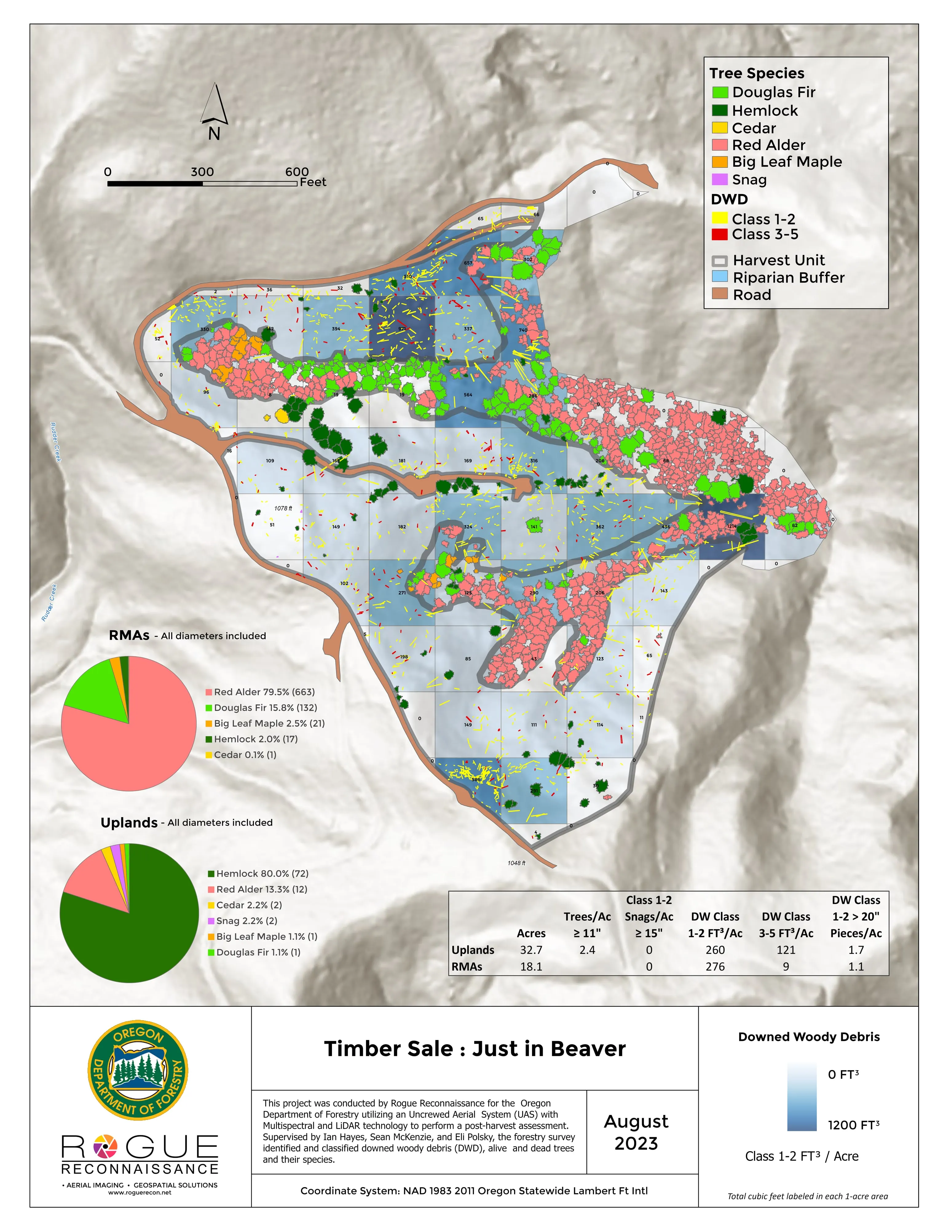
- Forest health tree by tree: Douglas fir, oak, and ash, with the accuracy figures reported
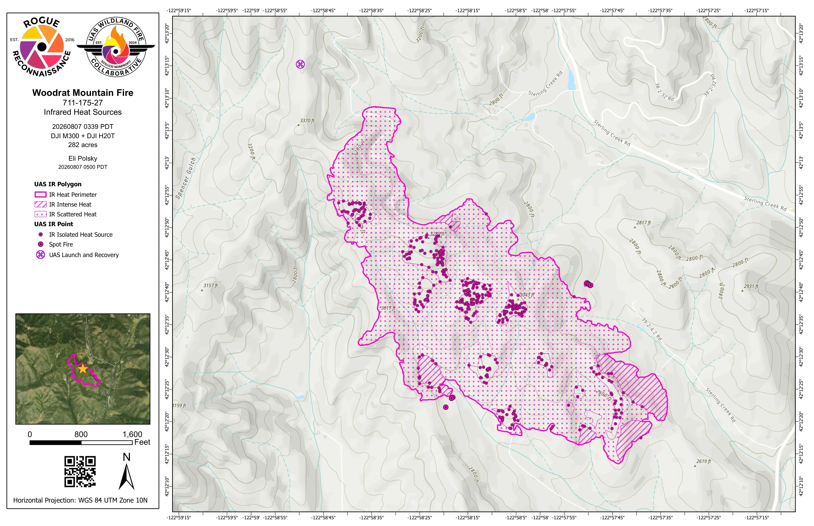
- Night infrared perimeter and heat products on wildland fire, in the schema every incident GISS already uses
- Design ready terrain and canopy data for architects, engineers, and landowners
- Redding
- Yreka
- Mount Shasta
- Eureka
- Ukiah
- Santa Rosa
- Chico
- Sacramento
Wildland fire
The same night package, either side of the line
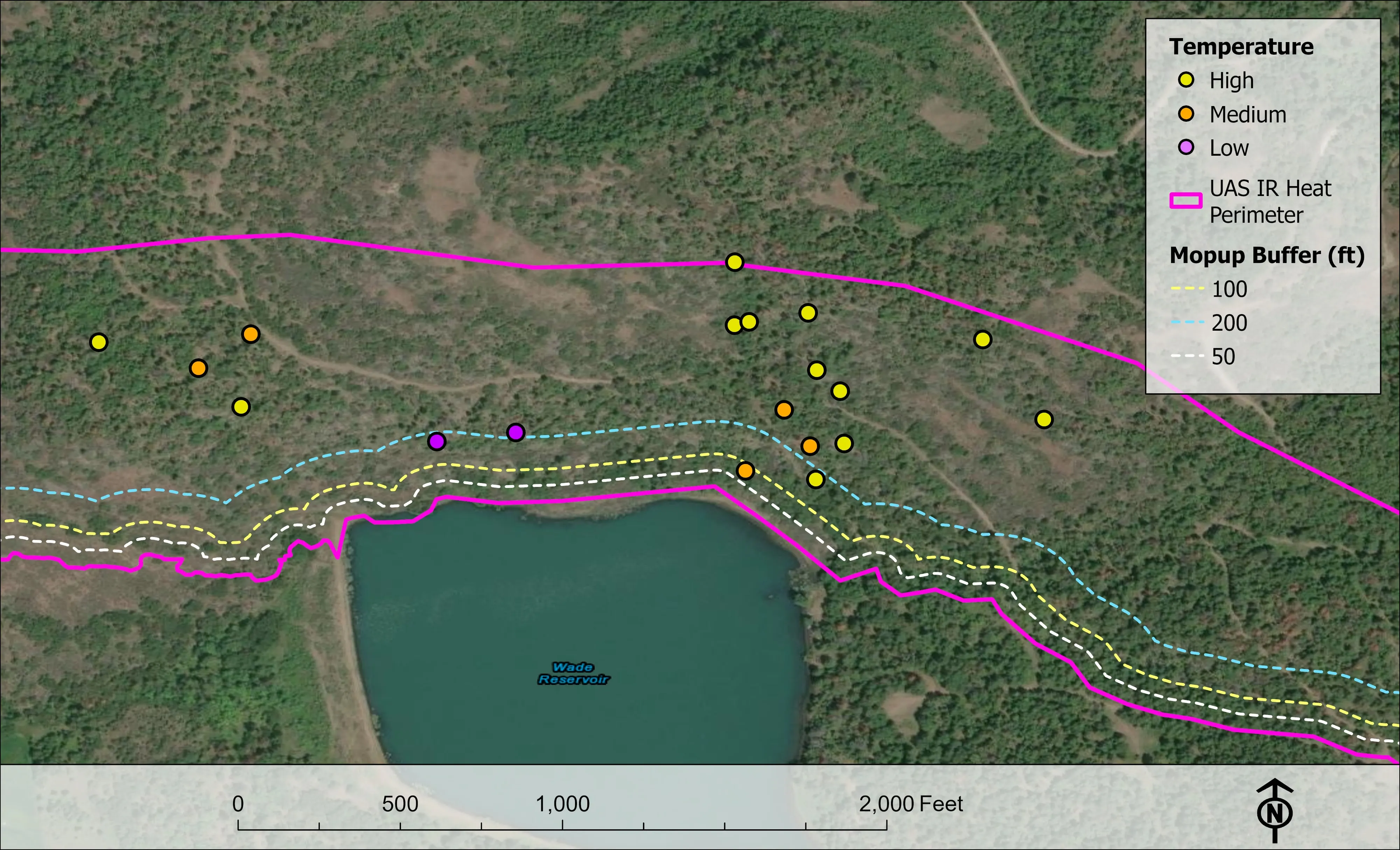
Oregon's fire season is California's fire season. On an active incident we fly infrared after dark and hand the incident management team the heat perimeter, intense and scattered heat, isolated heat points by intensity, and the mopup buffers, as a shapefile, a geodatabase, a KMZ, and an 11 by 17 map, before the morning briefing. The products follow the NIFS schema and carry the IRWIN identifier, so a California GISS drops them straight into the incident map.
We hold FAA Certificates of Authorization, carry the NWCG red card and the USFS Administratively Determined qualifications, and have flown as an Oregon Department of Forestry Call When Needed resource since 2019. A California agency or contractor can order the same resource.
Where the work is
Northern California, region by region
Siskiyou County and the Klamath
Three hours from Medford. Riparian species and thermal mapping on a river corridor near Etna, where we classed fourteen species across 423 acres and mapped the cold water the fish depend on. Timber, restoration, and fire on both sides of the state line.
Shasta County and Redding
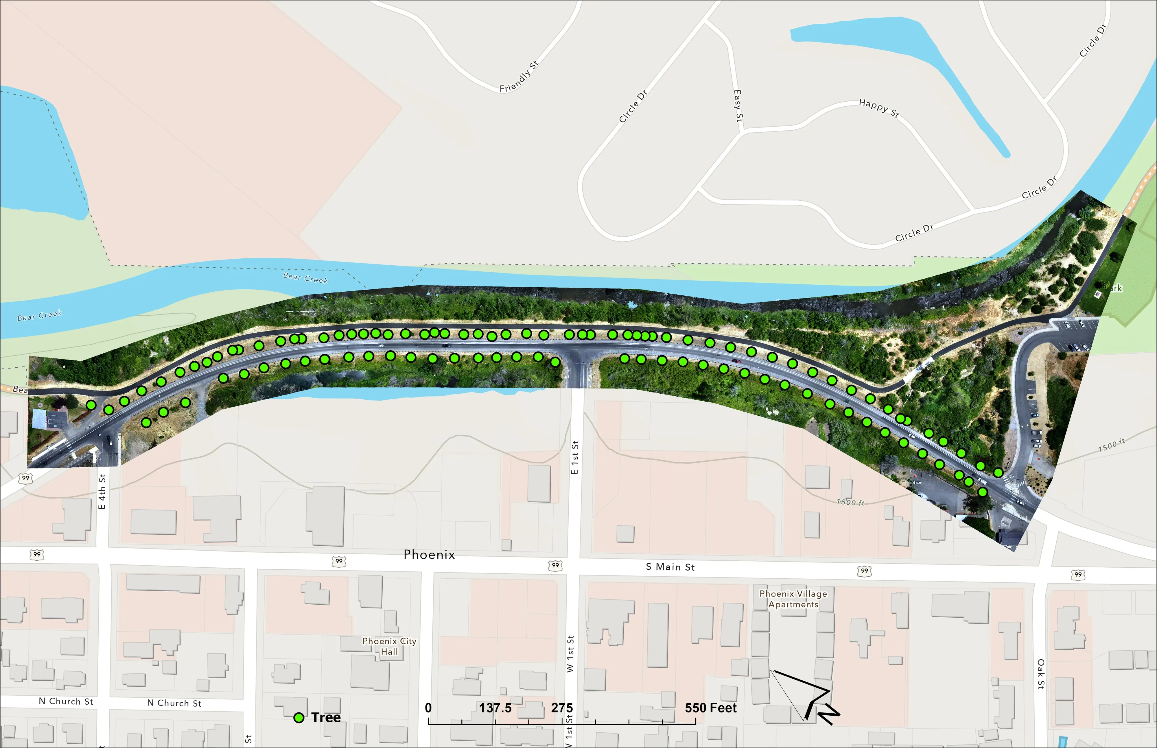
Tree inventory and terrain for a parcel with a licensed surveyor partner, delivered as classified LiDAR, orthomosaic, and CAD vegetation. Site design ground for architects and engineers around Redding, and forest health on the timber lands north of the lake.
Mendocino County and the North Coast
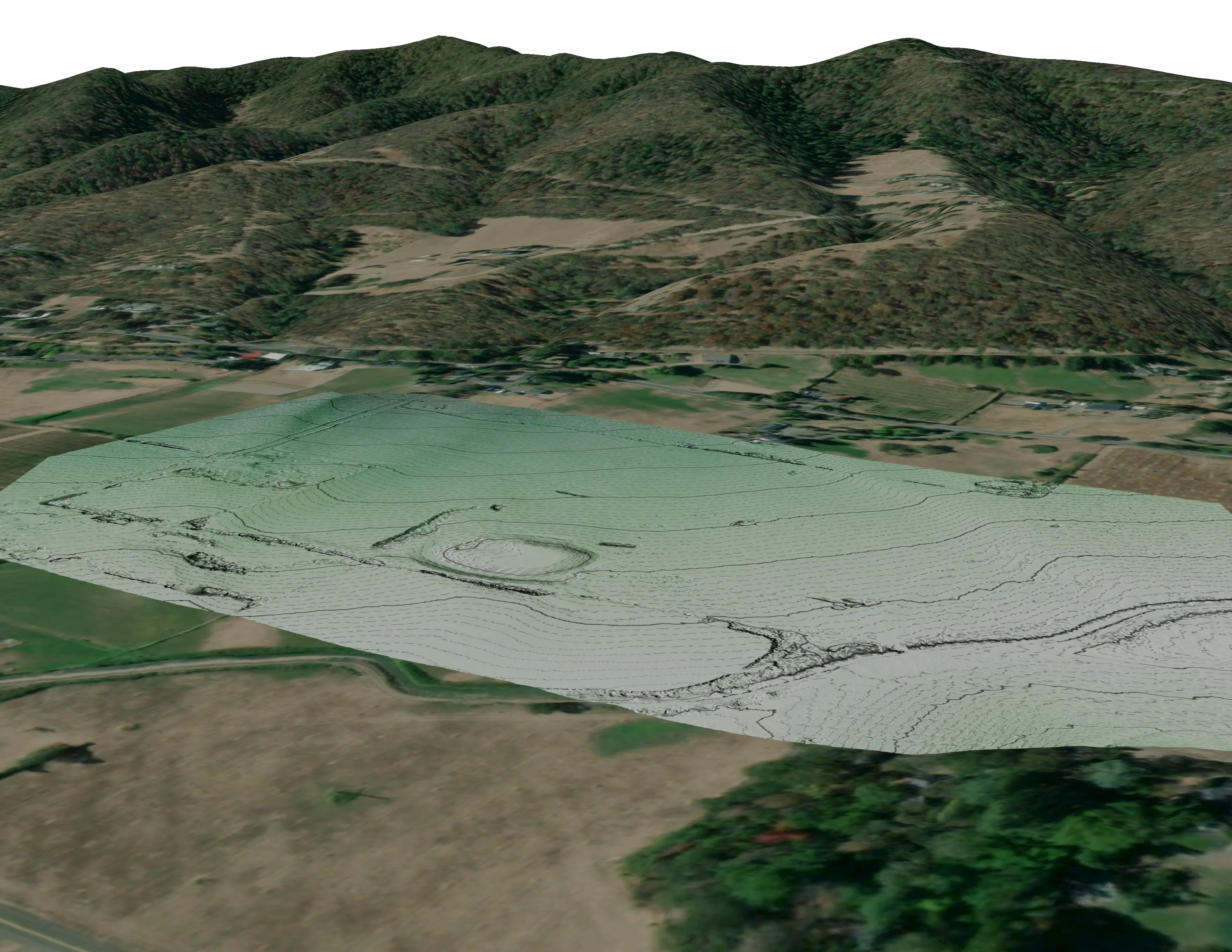
Drone LiDAR over abandoned mine sites for a federal land office, 778 acres of steep chaparral under the canopy, bare earth and canopy height for habitat work. Redwood and Douglas fir stands, watershed councils, and the coast from Ukiah to Eureka.
Sacramento Valley and the foothills
Orchards, row crop ground, and levee districts with drainage to plan; foothill timber and fuels work for counties and fire safe councils; design ready terrain for the growing towns from Chico to Sacramento.
What we map
Four lanes, in California
Let's talk about your California project.
Tell us the ground, the county, and the season. We will answer with what we would fly, what comes back, and when.
Email info@roguerecon.net or call 541 708 2151.