

Washington
Drone LiDAR and fire mapping across Washington.
Timber country, orchard country, and a fire season that runs with ours. The same aircraft, sensors, and products we fly in Oregon, flown in trips across Washington.
What we fly in Washington
The stand, the orchard, the corridor, and the fire
A Washington stand, orchard, building site, or line corridor gets the same flight and the same products as the Oregon work on this site. Drone LiDAR for the ground, the trees, and the wires. Multispectral for what is alive and what is not. Thermal for water and for fire. A current orthomosaic to draw on. Products come back in Washington State Plane, NAVD88 feet, in the formats the forester, the engineer, the district, or the incident already uses. Tell us where the ground is and roughly when, and we plan the trip around it.
- Night infrared perimeter and heat products on wildland fire, in the schema every incident GISS already uses
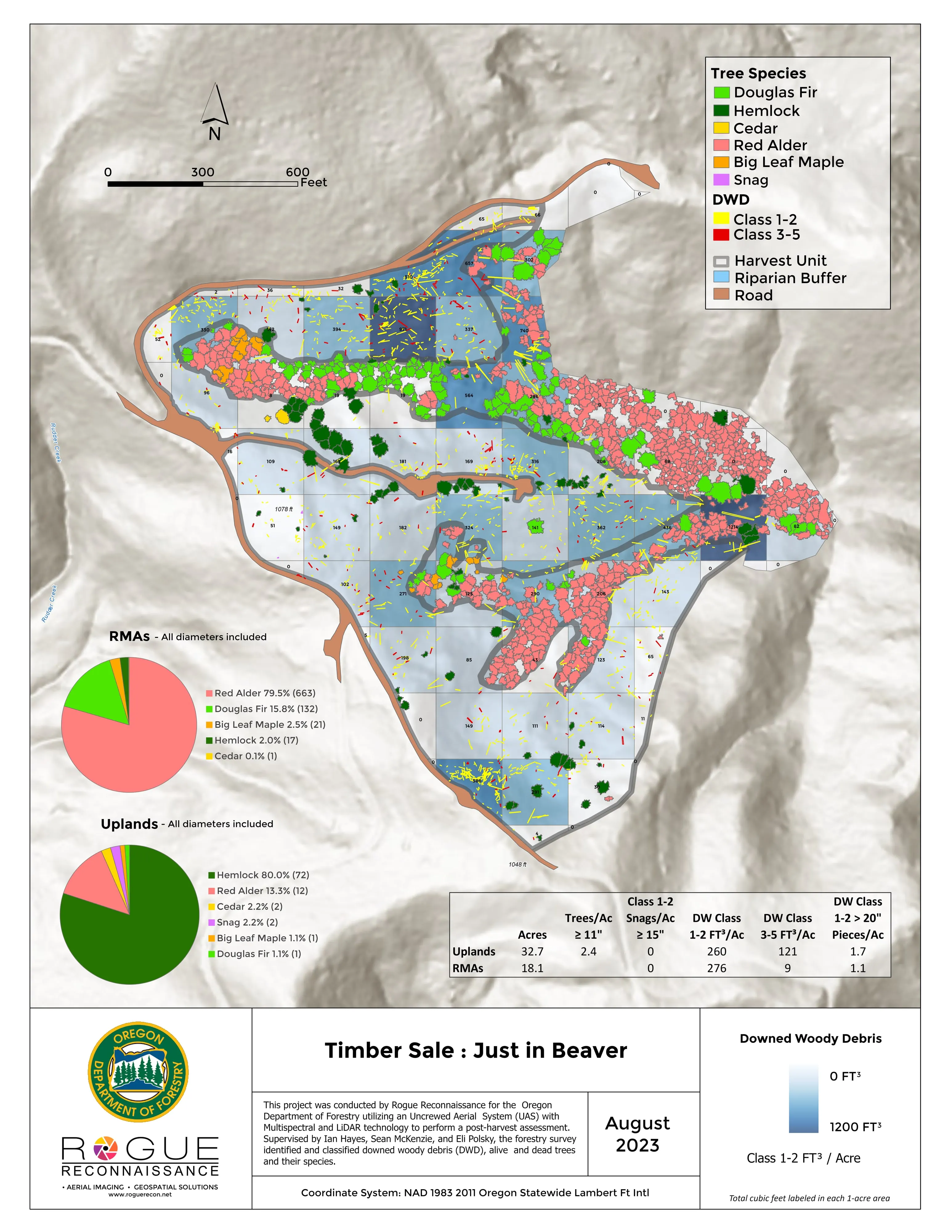
- Forest health tree by tree, post harvest assessment, and downed woody debris by decay class
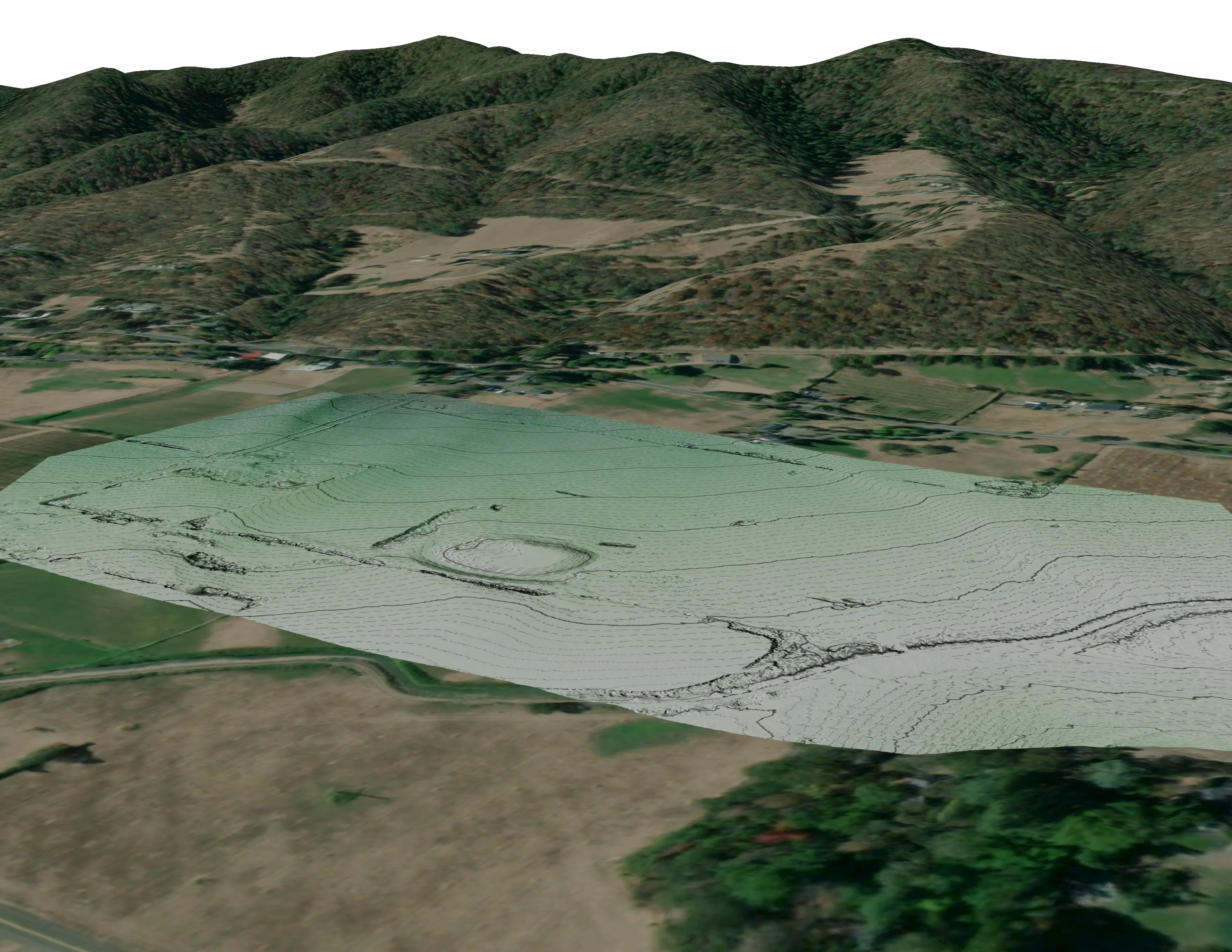
- Farm and orchard planning maps: drainage low points and flow paths, slope and aspect, canopy, plan overlays
- Vegetation management for public utility districts: corridor LiDAR, clearance and encroachment maps, danger tree lists
- Design ready terrain and canopy data for architects, engineers, and landowners
- Spokane
- Yakima
- Wenatchee
- Kennewick
- Olympia
- Tacoma
- Seattle
- Vancouver
Wildland fire
The same night package, one state north
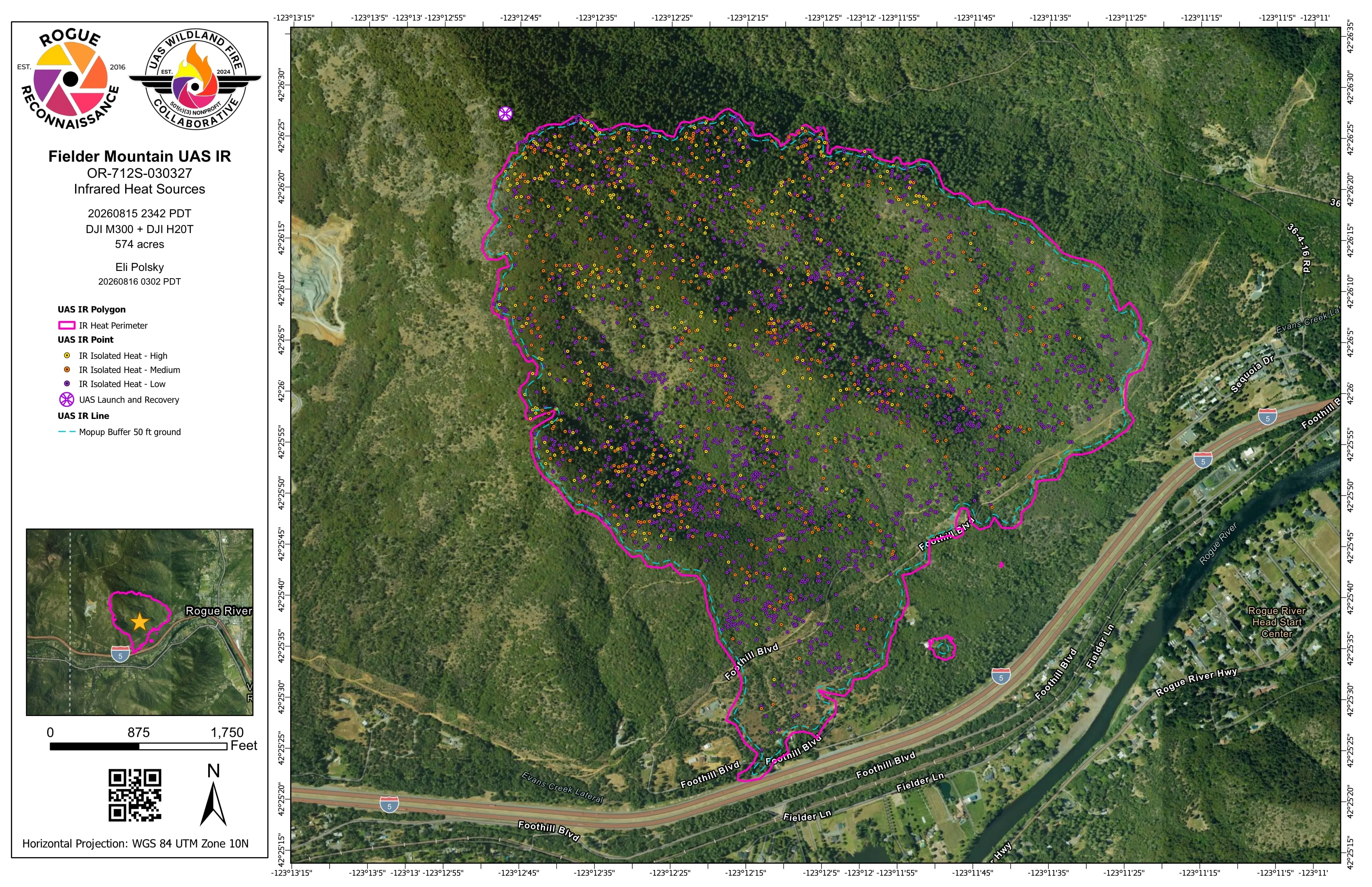
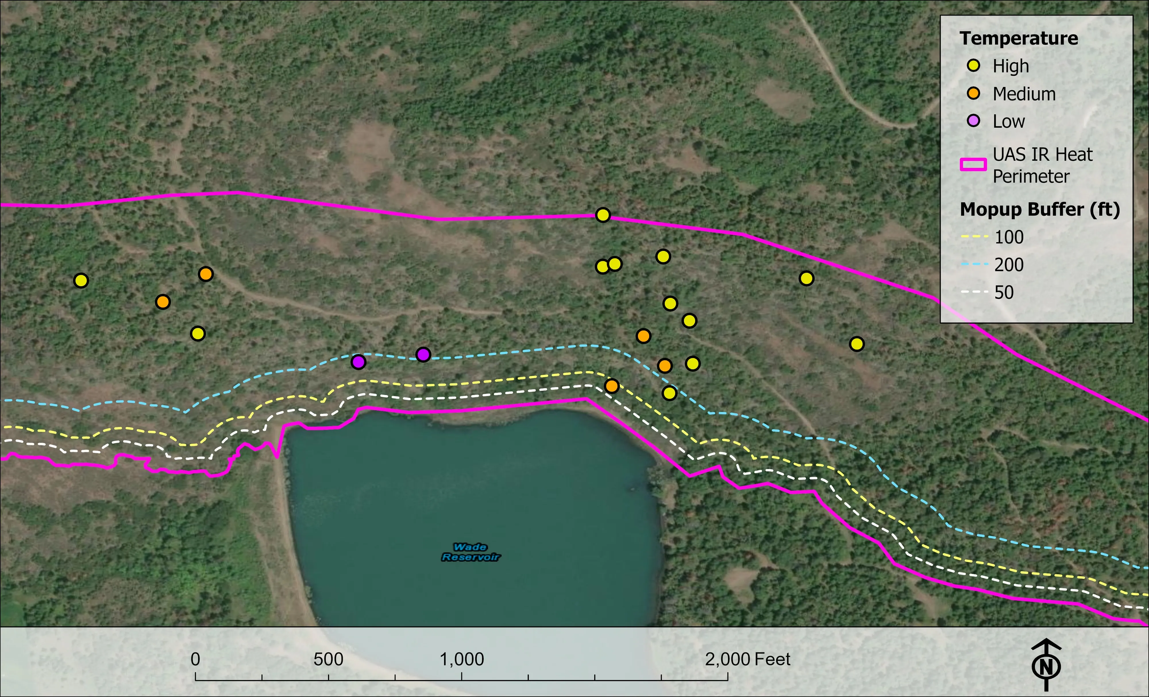
On an active incident we fly infrared after dark and hand the incident management team the heat perimeter, intense and scattered heat, isolated heat points by intensity, and the mopup buffers, as a shapefile, a geodatabase, a KMZ, and an 11 by 17 map, before the morning briefing. The products follow the NIFS schema and carry the IRWIN identifier, so a Washington GISS drops them straight into the incident map.
We hold FAA Certificates of Authorization, carry the NWCG red card and the USFS Administratively Determined qualifications, and have flown as an Oregon Department of Forestry Call When Needed resource since 2019. A Washington agency, a tribe, or a contractor can order the same resource.
Where the work is
Washington, region by region
Spokane and the Inland Northwest
Dry side timber, wildland urban interface, and the fire seasons that go with them. Night infrared on active incidents, fuels and structure exposure data for county wildfire plans, and forest health tree by tree on state, tribal, and private ground.
Yakima, Wenatchee, and the orchard valleys
Orchard blocks, vineyards, and row crop ground with drainage, slope, aspect, and sun to plan around. Canopy and windbreak height from LiDAR, plan overlays on a current orthomosaic, and the line corridors that cross the valleys for the public utility districts.
Olympia, Tacoma, and Seattle
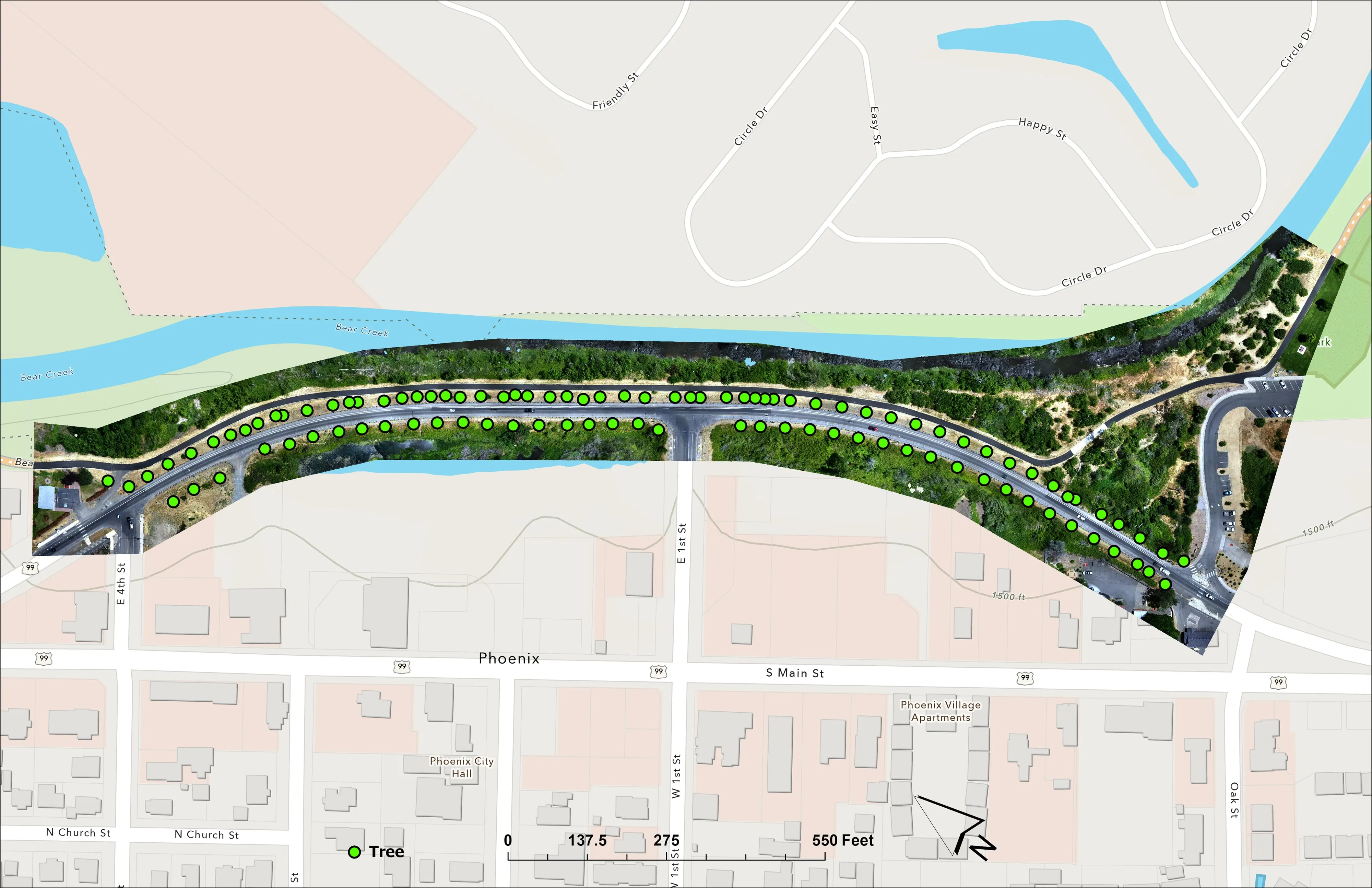
Design ready terrain and canopy data for architects, engineers, and developers on hillside and waterfront sites, in Washington State Plane and the formats the engineer imports. Tree inventory and canopy for cities and parks.
The Tri Cities and Vancouver
Farm planning maps for the irrigated ground along the Columbia and the Snake, riparian and floodplain products for conservation districts, and site terrain for the towns growing on both rivers.
What we map
Four lanes, in Washington
Let's talk about your Washington project.
Tell us the ground, the county, and the season. We will answer with what we would fly, what comes back, and when.
Email info@roguerecon.net or call 541 708 2151.