

Jefferson City, Missouri
The capital on the bluff, where the state's land agencies buy maps.
Jefferson City is the Missouri River on a limestone bluff, the state capitol and the agencies that manage Missouri's forests, parks, conservation lands and roads, and a working farm landscape in every direction. Design terrain, corridor LiDAR and canopy are the flights that fit, and the agencies are the buyers.
The ground
Jefferson City and Cole County and Callaway County
The capitol stands on the bluff above the Missouri with the river bottoms and Callaway County across the water. Behind the city the land rolls south in oak and hickory hills toward the Osage River and the Lake of the Ozarks; the Katy Trail runs along the north bank. Farms, timber and the cooperative lines fill the counties around it, and the Runge conservation area and the state parks sit at the city's edge.
Who buys mapping here
- The Missouri Department of Conservation, headquartered here, and the Runge Conservation Nature Center
- Missouri State Parks and the Department of Natural Resources; the Missouri Department of Transportation's central office
- City of Jefferson: Public Works, Parks, Recreation and Forestry, Planning
- Cole County and Callaway County: Public Works, Emergency Management
- Three Rivers Electric Cooperative and the cooperatives of mid Missouri; Ameren Missouri's corridors
- Lincoln University and its agricultural research farms
- The Katy Trail and the river bottom landowners; the Osage River valley farms
- Engineers and developers building on the bluffs and in the hills south of town
Getting there
From Medford
Jefferson City is half an hour south of Columbia and Interstate 70, two and a half hours from either big airport. It pairs with Columbia on the Missouri trip.
The public lidar
What exists, and what it misses
The state's own lidar covers Cole and Callaway counties and the agencies that commissioned it work from it daily. For a site on the bluff, a corridor through the hills, a conservation area's forest or a farm's drainage, the question is the current ground and this year's trees at a finer scale, which a drone flight of the parcel answers.
What we would fly
The lanes that fit Jefferson City

Nearest work
No Missouri flight is logged yet. The work that shows the method: a campus mapped for engineers with the control on the sheet, a corridor counted tree by tree, and a timber unit's debris measured from the air.
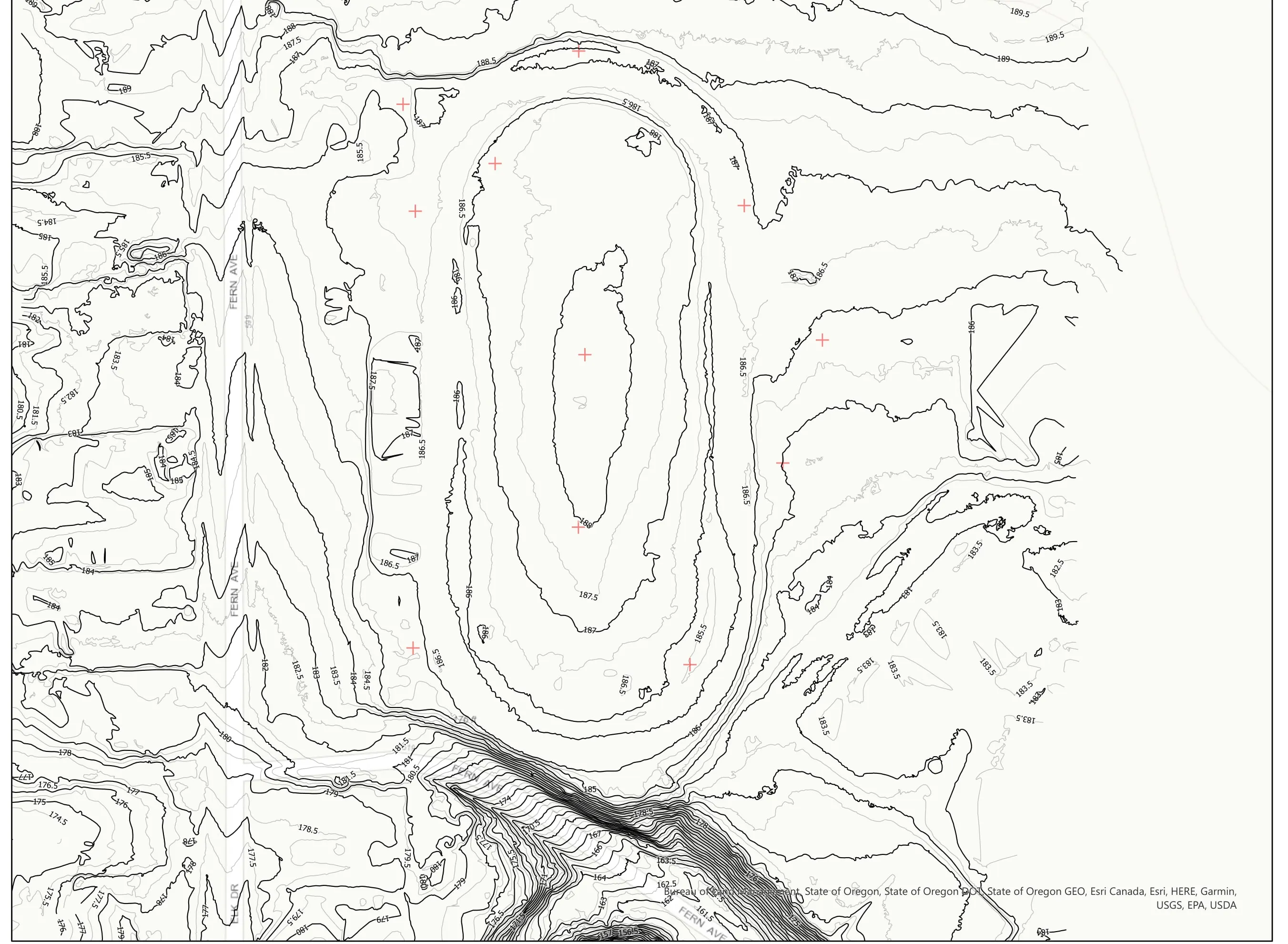
A school site, ready for the engineers
Pacific 3D Reality Capture, for the Brookings Harbor High School campus
Drone LiDAR terrain and contours over a 37 acre school campus, delivered as plan sheets and CAD ready data for the design team.
Read the case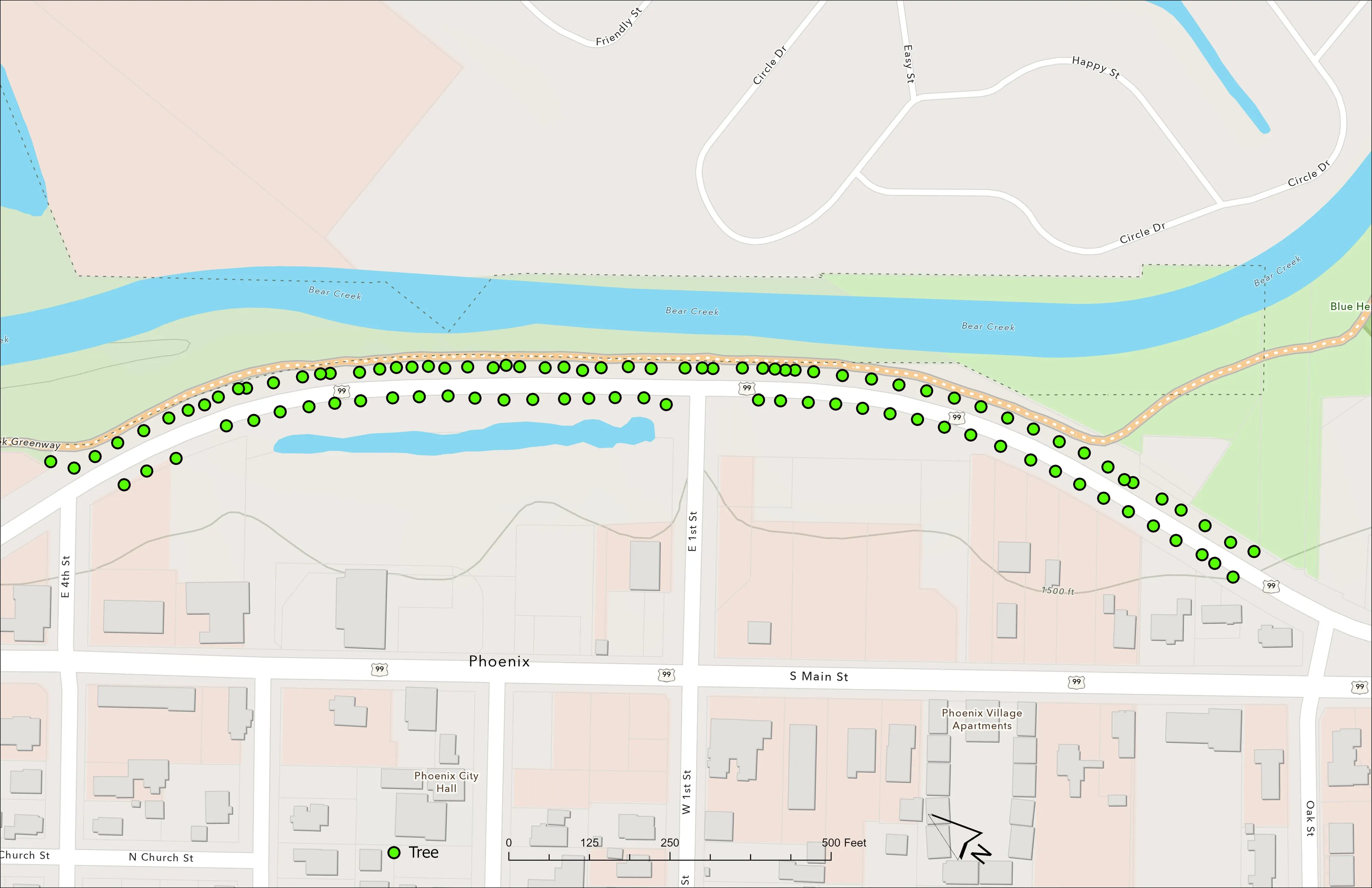
A planting corridor through Phoenix, tree by tree
City of Phoenix
The year one record for 98 trees the city planted where the Almeda fire burned through Phoenix, from drone LiDAR and RGB flown 65 days after planting.
Read the case
Downed woody debris, measured from the air
Oregon Department of Forestry
Every log on a post harvest unit delineated, measured, and classed by decay, with standing trees identified to species.
Read the caseThe record
Our published forestry, river, terrain and farm work
Forestry and trees
- Downed woody debris, measured from the air
- Finding every Oregon ash before the borer does
- At risk, declining, dieback, dead
- Post harvest monitoring for ODF
- A planting corridor through Phoenix, tree by tree
Rivers and habitat
- Riparian species and cold seeps on the Scott River
- Ten abandoned mines, bare earth under the chaparral
Terrain and site design
Farm planning
Jefferson City, with the agencies in mind.
A pilot for a state program, a site on the bluff, a corridor or a farm. Tell us the ground and the office asking and we will plan the stop.
Email info@roguerecon.net or call 808 298 6290.